What is OZONE?
A geospatial-intelligence console — one screen that puts eyes on any point on Earth in real time. It combines live and recent satellite imagery, stackable intelligence layers (conflict, infrastructure, economy, environment, movement), atmospheric nowcasting, and a fusion view that surfaces compound risk, then compiles a branded intelligence brief or target dossier on demand.
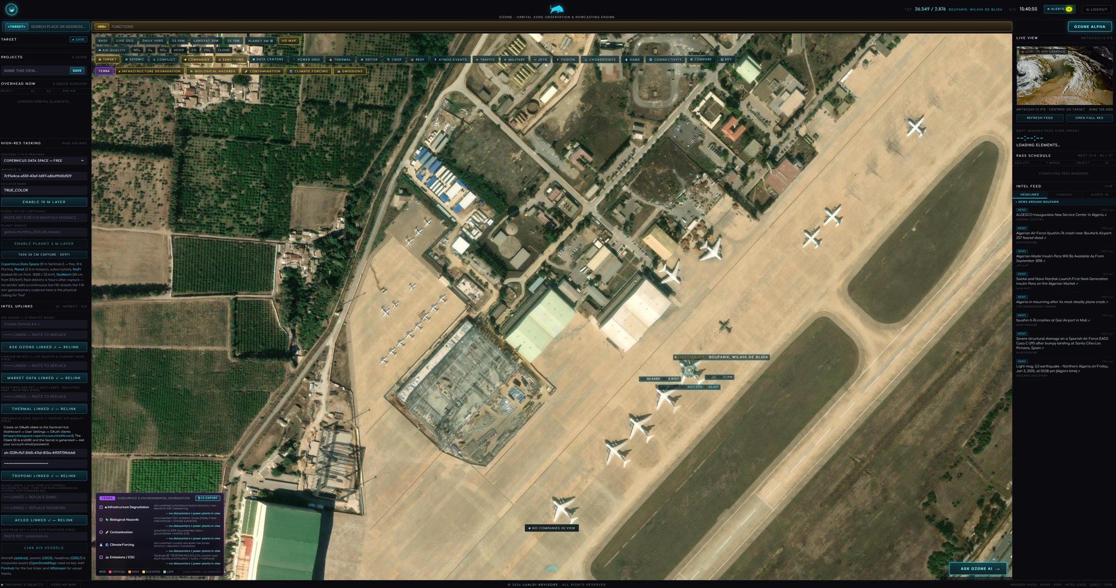
What can you put on the map?
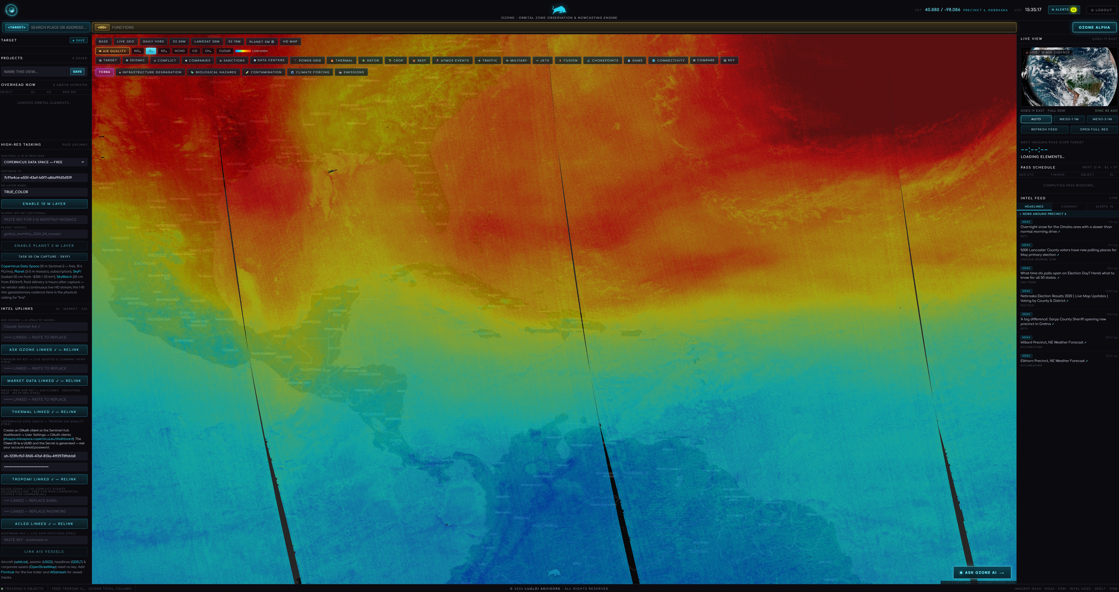
Pick an imagery base — from a high-definition satellite map down to recent decametre-to-metre passes and a live weather-satellite nowcast — then stack indicator layers: conflict events, military and air movement, power plants and the transmission grid, data centers, dams, corporate footprints, sanctions and watchlists, maritime chokepoints, thermal hotspots, deforestation, crop vigour, air quality and emissions, and connectivity. Layers load by viewport, so panning and zooming populates them.
What does the fusion view do?
It cross-correlates the active layers to surface compound risk a single layer would miss — for example critical power sitting inside a conflict zone, a sanctioned entity on a shipping chokepoint, or connectivity going dark in a war theatre. It points you to where to look; the underlying correlation logic is proprietary.
What outputs does it produce?
One-click, branded PDFs: a Region Intelligence Brief that compiles every active layer for the current view — executive summary, conflict, infrastructure, economy, connectivity, orbits and headlines — and a Target Dossier for a single location with satellites overhead, the next imaging passes, nearby seismic activity and headlines. A before-and-after date compare swipes recent imagery.
Where does the data come from, and is it private?
OZONE fuses authoritative geospatial and intelligence feeds into one console. The exact source mix and the fusion logic are proprietary; sensitive credentials are held server-side and never exposed to the browser. It runs self-hosted, so your targets and projects stay within your perimeter.
Who is it for?
Defense and government analysts, corporate security and risk teams, commodity and supply-chain desks, ESG and emissions reviewers, and investors who need situational awareness over physical assets, theatres and counterparties — anyone who needs to see and brief what is happening on the ground, anywhere, fast.